


.jpg)
.jpg)

Waterfront development accounts for a majority of the development activity in the Township. Due to the sensitive nature of permitting development in close proximity to waterbodies, the Township has adopted a number of application processes and policies to ensure the long-term protection of this important environment while permitting an appropriate amount of development for private land owners. See Waterfront Official Plan Policies.
All development adjacent to any waterbody must be setback a minimum of 30 metres (100 ft) from the high-water mark. Some exceptions to this are permitted such as marine facilities, and small gazebos. The Accessory Uses (Section 3.1) section of the Zoning By-Law should be referred to for specific regulations for these types of structures. In addition to the setbacks from the water, other regulations such as lot coverage and floor space index may impact development on the waterfront as well. See Waterfront Zoning Regulations.
A majority of development within 100 metres of a waterbody, regardless of whether the development meets all zoning regulations, must receive Site Plan Control approval unless the development is less than 30m2 (320ft2). Site Plan Control for waterfront development reviews issues such as drainage, septic system location, visual impact, protection of natural features, slope stability, erosion potential, and preservation of shoreline vegetation.
Any development that cannot comply with the Zoning By-Law regulations for waterfront development must receive planning approval prior to commencing construction. Relevant applications may be able to be applied for simultaneously.
The following are excerpts from the Waterfront Development section of the Official Plan:
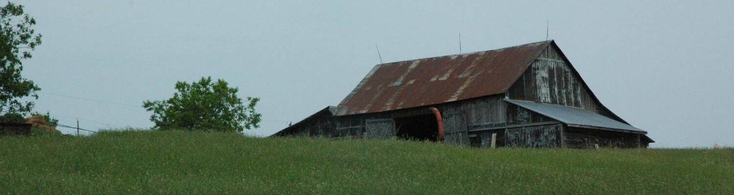
Historically, the areas of the Township which abut or are adjacent to the Rideau Waterway and the Township’s many lakes and rivers have attracted tremendous interest as summer recreational areas. Over the years, low density seasonal dwellings evolved in a linear fashion as waterfront areas were discovered by residents of nearby towns and various communities much farther away, such as Ottawa and Toronto, as well as the United States of America. This is hardly surprising, given the beautiful shoreline areas of Rideau Lakes with their fabulous aesthetic appeal and superb leisure and recreational opportunities.
The cottages that were constructed in the Township’s waterfront areas traditionally functioned solely as secondary residences used on a seasonal basis by their owners, whose principal place of residence was located elsewhere. Road access, where available, has generally been by private road. This form of development has a long tradition in Rideau Lakes and many other jurisdictions.
The waterfront areas of the Township are also distinguished by the presence of other long-standing uses that are functionally-related to the water. These include parks, lock stations and a range of tourist commercial uses such as resorts, summer camps, campgrounds and marinas.
In recent years, there have been pressures across cottage country (both in the Township and elsewhere) to use waterfront residential properties on a more intensive, multi-season basis. The reasons for this are related to a broad range of factors including, among others, demographic and lifestyle considerations. The trend has been associated with the improvement and enlargement of existing dwellings and private sewage disposal and water systems, the creation of new lots through the consent process, the construction of increasingly larger new dwellings on existing vacant or new lots and changes in occupancy from secondary or seasonal use to principal or permanent use.
As undeveloped waterfront property becomes increasingly scarce, as existing properties become more intensively used, and as pressures mount to permit higher density development, there is need to ensure that appropriate Official Plan policies are in place to ensure the protection of the Township’s waterfront area’s unique physical and environmental character.
While the character of specific waterfront areas varies, some of the key elements of this character are:
- The unique and limited land use mix, overall low density of development and distinct form and massing of buildings;
- The presence of spectacular vistas and alluring natural landscapes, and the integration of buildings and structures into those landscapes with minimal disturbance;
- The private roads which generally provide road access to waterfront properties, as well as the low-volume design of such roads, which is typically dictated by, and adapts to, topography and vegetation;
- The important role of the water and shoreline areas in supporting natural heritage features, through the provision of habitat for flora, fauna and aquatic life;
- The contributions of the water and shoreline areas in terms of cultural heritage, leisure and recreational opportunities, as well as economic and employment benefits in the service sector, resulting from tourism and recreational property development.
Given the importance of maintaining the long-term quality and character of water bodies and their environs, the following development policies relating to lake capacity, water setbacks, water frontage, narrow channels and boat capacity shall apply:
- Lake Capacity
- Big Rideau Lake is the only cold-water lake in the Township and it is managed as a lake trout lake by the Ministry of Natural Resources. Based on dissolved oxygen profiles and lake capacity modelling, Big Rideau Lake is classified as moderately sensitive. All other lakes in the Township are warm water lakes. All Township lakes can accommodate some limited additional development, based on current water quality.
- For any development proposal that would result in the creation of more than three lots or dwelling units having direct or deeded water access, a lake impact study to assess the effect of development and additional nutrient loadings on lake water quality will be required. A lake impact study shall also be required for any significant development proposal, as determined by the approval authority, for a non-residential use within 300 metres of a lake. The approval of such proposal shall not be granted where a negative impact on water quality would be the result.
- Water Setback
- An adequate water setback serves an important function in relation to the protection of the natural and cultural heritage characteristics and water quality of the lakes and rivers of the Township. The intent of a water setback is to prevent the disturbance of the shoreline area as a result of the placement of buildings and structures, including sewage systems, or the removal of the soil mantle and natural vegetation. In addition to preserving the natural aesthetic qualities of the shoreline as viewed from the water, an appropriate water setback can reduce phosphorus and other nutrient loads to the lake and, in combination with vegetation, prevent erosion and sedimentation. Development or site alteration such as filling, grading and excavating shall occur a minimum distance of 30 metres from the normal high water mark of any water body. The quantitative elements of this setback shall be implemented through the comprehensive Zoning By-Law, while the qualitative elements shall be addressed through the Site Plan Control process.
- Where lake-specific or site-specific conditions suggest that it would be appropriate, the minimum water setback may be increased. Examples of the latter would include sites with steep slopes, limited soil depth, sub-optimal (i.e. very high or very low) soil percolation rates or limited vegetative cover.
- Development or site alteration may be permitted less than 30 metres from a water body in situations where existing lots or existing developments preclude the reasonable possibility of achieving the setback. Additionally, there may be isolated cases where site-specific conditions would make it appropriate to reduce the setback in relation to a proposed lot. Any proposal for development or site alteration proposed to occur less than 30 metres from a water body shall be subject to the policies of the Fish Habitat and Adjacent Lands and Environmental Impact Assessments sections of this Plan.
- Water setback requirements shall not apply to docks, boathouses, pumphouses and other marine facilities accessory to permitted uses. Depending upon their location in relation to the water, such structures may require permits from approval authorities such as Parks Canada, the Ministry of Natural Resources and the relevant Conservation Authority in addition to, or instead of, approvals from the Township.
- It is the policy of this Plan to encourage the protection of existing natural vegetation from disturbance and the revegetation or naturalization of altered or disturbed shoreline areas through the development approval process. Among other tools, tree cutting by-laws and site alteration by-laws as authorized in the Municipal Act, as well as Site Plan Control may be utilized by the Township for this purpose.
- Water Frontage
- As a general rule, the minimum water frontage for any new waterfront lot shall be 60 metres. This requirement may be increased where lake-specific or site-specific conditions suggest that it would be appropriate and shall be implemented through the Zoning By-law.
- Where the creation of more than three non-waterfront lots from a waterfront land holding is proposed, a user-in-common deeded waterfront parcel of land shall generally be provided, such parcel to have a minimum water frontage of 15 metres per non-waterfront lot, or as otherwise determined by the Township.
- Water frontage requirements of this section shall be applied on a dwelling unit basis for any cluster-type development involving the proposed siting of more than one dwelling unit on a lot.
- Narrow Channels
- The confined nature of narrow channels and approaches to lockstations can result in safety and compatibility issues for boaters and landowners. A narrow channel is defined as a waterbody where the distance from shore to shore is 150 metres or less. Given the importance of ensuring public safety, the development of structures such as marine facilities will not be permitted in a narrow channel or an entrance to a lockstation where a hazard to navigation would result, as identified by the approval authority or Parks Canada, as applicable.
- New Lot Creation on Narrow Channels
- New lot creation on narrow channels will be permitted in accordance with the following:
- Where the distance of the narrow channel from shore to shore is 90 metres or greater, a minimum shoreline frontage of 90 metres is required.
- Where the distance of the narrow channel from shore to shore is less than 90 metres, a minimum shoreline frontage of 120 metres will be required.
- New lot creation on narrow channels will be permitted in accordance with the following:
- Boat Capacity on the Rideau Canal
- While the Rideau Canal does not experience boat capacity issues at this time, there are localized areas such as narrow channels, near existing marinas and in the vicinity of lockstations, where there is potential for boater conflicts. Proponents of large-scale water-oriented development projects will be required to consult with the approval authority and Parks Canada during the preparation of a concept to assess the effect of development on safe and enjoyable navigation of the Rideau Canal.
- Various land use and general development policies of this Plan support the preservation of waterfront areas and include policies that are aimed specifically at those areas. By way of example, particular regard should be had to the following sections of the Plan:
- Road Access and Private Roads sections of the Plan, for special policies that provide continuing recognition of, and support to, waterfront development with private road access;
- Environmentally-Sensitive Development section for policies to encourage development that fits into the existing natural and built environments, including minimizing disturbance to the natural environment adjacent to shorelines of water bodies;
- Fish Habitat and Adjacent Lands section, which sets out policies for the protection of water bodies as a vital component of natural ecosystems;
- Cultural Heritage Resources section, which speaks to the special cultural heritage significance of areas on or near water bodies in terms of the scenic vistas and landscapes that have resulted from the interplay between the built and natural environments.
- Archaeological Resources section, which underscores the importance of waterfront areas to our understanding of the history of First Nations peoples, the early settlement of the Township and construction of the Rideau Canal system.
- Natural Hazards Features section, which identifies potential flooding and steep slope concerns that can pose relatively greater risks to persons and property within waterfront areas.
- Surface Water Quality and Quantity section, which focuses on policies to protect surface waters, including the management of storm water to ensure that water bodies are not negatively affected by the scale, density or physical form of development;
- Consent Policies section of this Plan, which provides special policies facilitating limited lot creation in waterfront areas, including waterfront areas with private road access;
- Site Plan Control section which, in an attempt to more closely regulate the qualitative elements of waterfront development, extends site plan control requirements to all forms of development, including single dwellings where development is proposed adjacent to a water body.
- The Zoning By-law that implements this Plan shall include special zones and provisions to address specific waterfront policy concerns of this and other relevant sections of the Plan.
- Rideau Lakes possesses many areas which are special or unique. Some of these areas are of value because of the natural environment while others are special in relation to built form. It shall be a policy of this Plan that development be undertaken in a manner which is sympathetic and complementary to the natural and built contextual environment in which it is to occur. Development shall, to the extent possible, be designed so as to maintain, fit into and take advantage of the natural, scenic and historic character of individual sites and their environs. Some of the strategies to achieve this objective in the context of site planning, lot design, road layout and construction include:
- Massing of buildings and structures so as not to dominate the natural landscape, particularly in areas of high potential impact such as narrow waterways or areas with scenic vistas. Similarly, in areas such as villages and hamlets or in the vicinity of lock stations where the preservation of the heritage value of the built environment is the dominant concern, development should complement the character of existing buildings, structures and the surrounding landscape. Where appropriate, the Township shall circulate development applications to Parks Canada and/or the Local Architectural Conservation Advisory Committee (LACAC).
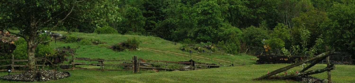
- Retaining as much natural vegetation as possible, as well as reinstating vegetative buffers that are disturbed or destroyed, particularly where they abut shorelines, roads or adjacent sensitive land uses. Priority shall be given to the use of native species of vegetation.
- Maintaining a minimum 15-metre strip of substantially undisturbed and naturally-vegetated area abutting the length of the shoreline on waterfront properties, subject to limited allowance for water-related structures such as docks, pump houses and boathouses. This strip will contribute to protecting the riparian and littoral zones and their associated habitat, prevent erosion, siltation and nutrient migration, and assist in maintaining the natural appearance of the shoreline area. The strip will form part of the 30-metre minimum water setback required pursuant to the Waterfront Development Policies section of this Plan and is intended to ensure the protection of the most environmentally-sensitive portion of the setback area. Parks Canada and the relevant Conservation Authority shall be circulated development applications, as applicable.
- Through the site plan process, ensuring wherever possible that buildings and structures along the shoreline, including marine facilities, do not generally occupy more than 25% of the water frontage of any lot, provided that this provision shall not apply to public uses, resorts or marina facilities and similar uses that require a functional relationship to the water.
- Preserving natural land forms and contours, particularly when undertaking grading or site alteration.
- Attempting to implement a “dark skies” policy, where practical, in relation to lighting on public roads, parks and on private property, in order to minimize light pollution and spill-over.
- Selecting storm water management approaches that maximize natural infiltration and minimize runoff, both during and after construction. The relevant Conservation Authority shall be consulted.
- The foregoing shall be implemented through the capital works program, the planning application process, appropriate zoning and other by-laws, as well as site plan, subdivision and other agreements.
- It is recognized that other elements such as architectural style and building cladding and colour are important components in the design of development that is sensitive to and reinforces the contextual environment. To the extent that the legislation provides for controls such as those pursuant to the Heritage Act, as well as through the Township’s support for the development and distribution of appropriate design guidelines by relevant agencies and organizations, the Township will endeavour to encourage development that complements its surroundings.
- The Township shall encourage property owners to consult with Parks Canada and the relevant Conservation Authority, as applicable, prior to filing planning applications in order that the principles of environmentally-sensitive development may be incorporated into development proposals at an early stage in the planning process.
The following are the relevant Zoning Bylaw regulations pertaining to waterfront development: * note: metric figures are accurate, imperial figures are rounded
Setbacks
Distance from that lot line to the nearest building wall
- Highwater Mark: 30m (100ft)
- Side: 6m (20 ft)
- Rear: 7.5m (25 ft)
- From Right of Way: 6m (20 ft)
Accessory Buildings
Same except 2m or 3m from side and rear lot lines depending on size
Lot Coverage
Maximum 10% lot coverage permitted
Definitions
Lot Coverage shall mean that portion of the area of a lot covered by all main and accessory buildings, porches, decks, swimming pools and similar features, but excluding automobile service station pump island canopies, entrance canopies for non-residential buildings, and balconies and overhanging eaves which are more than 2.5 m above finished grade. In the case of a lot which abuts a water body, lot coverage shall be calculated on the basis of the portion of the lot which is located within 60 m of the water body.
Floor Space Index
Maximum 15% floor space permitted
Definitions
Floor Space Index shall mean the ratio of the total floor area of a dwelling and any sleeping cabin, if applicable, to the area of the lot on which the dwelling is situated, expressed as a percentage. In the case of a lot which abuts a water body, the floor space index shall be calculated on the basis of the portion of the lot which is located within 60 m of the water body.
Floor Area shall mean for a dwelling or dwelling unit, the total area of the storeys contained within the exterior walls of the dwelling or dwelling unit, exclusive of any garage, carport, unenclosed porch or deck, unfinished attic, unfinished basement or unfinished cellar;
Sleeping Cabins
Definitions
Sleeping Cabins shall mean a single storey building which provides accessory sleeping accommodation and which may contain washroom facilities, but which shall not include a kitchen or other food preparation facilities.
Section 3.1.7
On a lot which both abuts a water body and is situated in a Residential or Rural zone, one sleeping cabin shall be a permitted accessory use, provided that:
- The maximum floor area, including attached decks, of a sleeping cabin shall be 25 m2.
Yard and Water Setback Encroachments
Notwithstanding the yard and setback provisions of this By-law, the following encroachments are permitted:
- Sills, belt courses, chimneys, cornices, eaves, gutters, parapets, bay windows and other ornamental features may project into any yard or water setback by not more than 0.6m;
- Attached decks and balconies may project from the main building into any minimum required yard setback by not more than 3m
- Attached decks and balconies may project from the main building into any water setback by a maximum of:
- 1.2m where the main building is located less than 8m from the high-water mark. This deck shall be limited to 2m2 of horizontal surface area;
- 2m where the main building is equal to or greater than 8m but less than 15m from the high-water mark. This deck shall not be limited in horizontal surface area; or
- 4m where the main building is equal to or greater than 15m. This deck shall not be limited in horizontal surface area.
- Awnings, clothes poles, flag poles, garden trellises, fences, plant materials, play structures under 15m2, temporary event tents, stairs, ramps for accessibility, landings (as minimal as required by the Ontario Building Code) and similar accessory structures shall be permitted in any required yard or water setback;
- Swimming pools may be permitted in a required interior side or rear yard, provided that the minimum yard shall be 3m. Swimming pools shall not encroach into the required water setback such that the water setback of the pool would be less than that of any existing non-complying dwelling or non-residential main building. For the purposes of this section, hot tubs shall not be considered to be swimming pools.
For added clarity, an accessibility deck shall only encroach into the water setback when a main building has a water setback equal to or greater than 8m. An accessibility deck shall maintain the minimum required yard applicable to all other decks.
Water Setbacks
Except as otherwise permitted by Sections 3.15, 3.30 and 3.31 of this By-law, the minimum water setback shall be 30 m for all buildings and structures, including all sewage disposal systems but excluding the following:
- Decks, gazebos and other similar structures such as hot tubs, which are unattached to a main building and which have a combined horizontal surface area of less than 14 m2;
- Marinas, pump houses, marine facilities and stairs.
Size and Frontage Requirements for New Lots
- Minimum Size: 4050 sq m (1 acre)
- Minimum Water Frontage: 60m (200 ft)